North of Hurstpierpoint is Cuckfield Road that was still labelled “New Road” in the Estate Agents maps of the 1950’s! The 1675 map does not show the Turnpike Road though in 1973 hedge counts show an age of 700 years to match beautifully the 13th century licence. Using a computer red dash lines show where the “New” hedges should be. Similar species are found on both sides including Spindle a shrub that Dr Hooper states will indicate a hedge of 600 years. And he is right! See 1658 map 2. formula.
But if this is a copy of a Roman map why aren’t Margary's Roman Road’s shown as on O.S. maps?
Ivan Margary was one of the first persons to attempt to find Roman roads in Britain. He was very successful but was doubtful about those in the Weald hence the title of his book “Roman Ways in the Weald”.
In the Preface to the First Edition he states, “UNTIL COMPARATIVELY RECENT TIMES IT WAS USUAL TO REGARD” (his capitals) the Weald as being “trackless and impenetrable” in ancient days.
On page 17. “We shall see that the Wealden Roads probably include examples of all types of Roman Road except for those of military need, for, from what is known of the invasion by the Emperor Claudius in A.D. 43, it is doubtful if any military action was needed in this area and the development of the roads may have been undertaken entirely for civil purposes.”
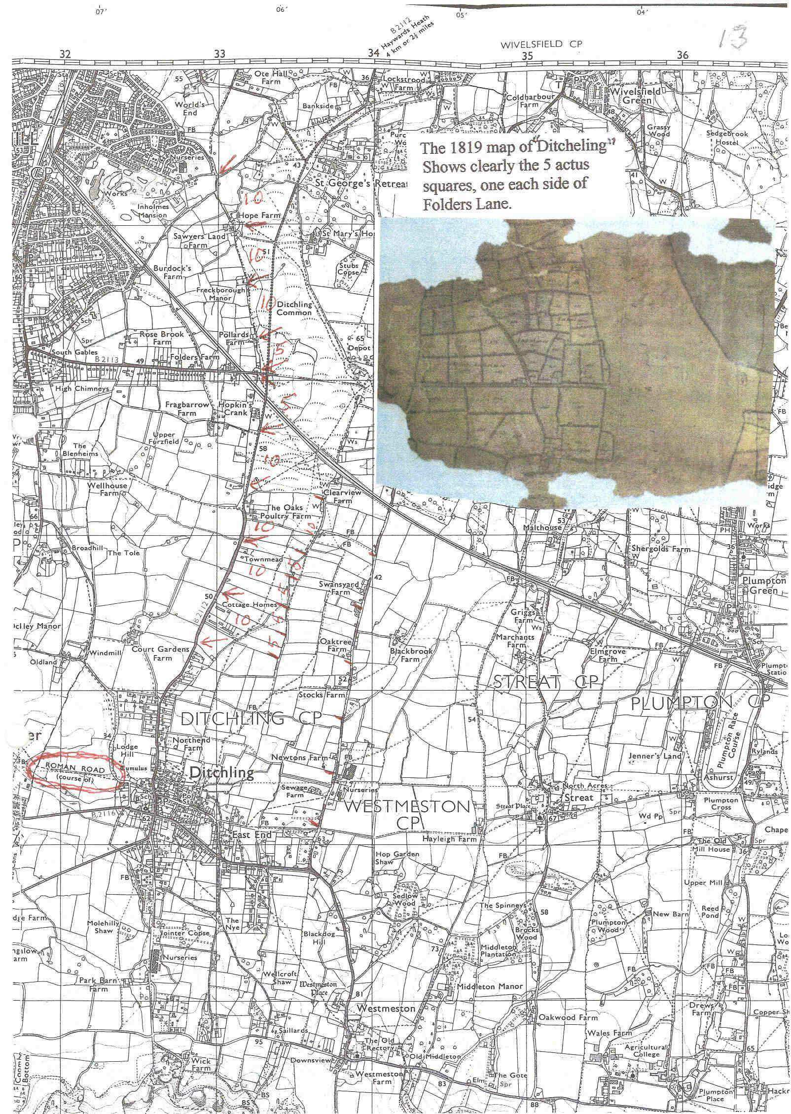
MAP (4)
On page 19 he describes several ways in which a road can be entirely covered up in time but fails to mention the activities of earthworms as described by Darwin. Worms take soil from below solid objects and eject soil around and above solids so stones sink to the level below which earthworms do not work. This was very obvious in the sandpit at Hurstpierpoint before it was filled in. The level layer of flints are on the Roman Road route and have often been quoted as evidence for the road but Darwin would not agree!
On page 23. “Thus it is probable that a considerable number of east-west roads were already available in the Weald when the Romans came, but, save for local work, these would not have been much value to them.”
During the spring of 1973 I spent much time measuring field boundaries in Roman figures, the actus, so in the autumn when this problem arose I was able to find an answer. The Burgess Hill/Ditchling Common boundary showed that many old farms and field boundaries on the Burgess Hill side were 5 or 10 actus apart and there were more wells than those shown on Ordnance Survey maps, which suggests that it was a fortified boundary to some extent.
Other Roman fields crossed Roman Roads at an angle as though Roman Surveyors ignored the road. At the time Margary had few methods of ascertaining the true age of these “Ways” but he did note on page 172 --- “ 3rd and 4th century Roman pottery lay upon the road and particularly towards it’s north side, suggesting by the position of the deposit that it had by then ceased to be in use as a highway.”
When one accepts that the hedges are not 150 years old but must be 700 years old, an impossible error, one has to find good evidence to provide answers to the Roman Roads problem. I hope others will find much more evidence in other areas.
The possibility that the “Roman roads” were built after the maps were drawn is contradicted by the manner in which roads cut across fields that are of Roman measurement.
---o---
To go to the next page click HERE
To go to the previous page click HERE
To return to the contents page click HERE