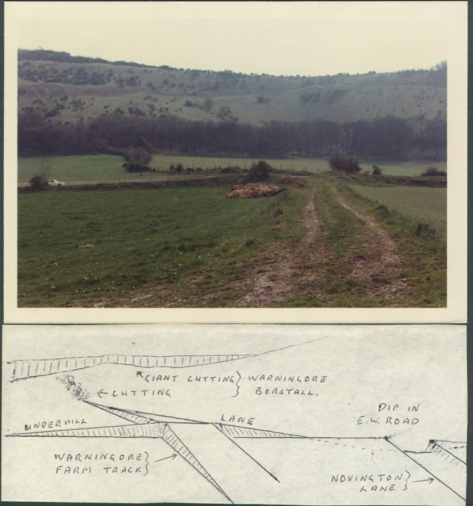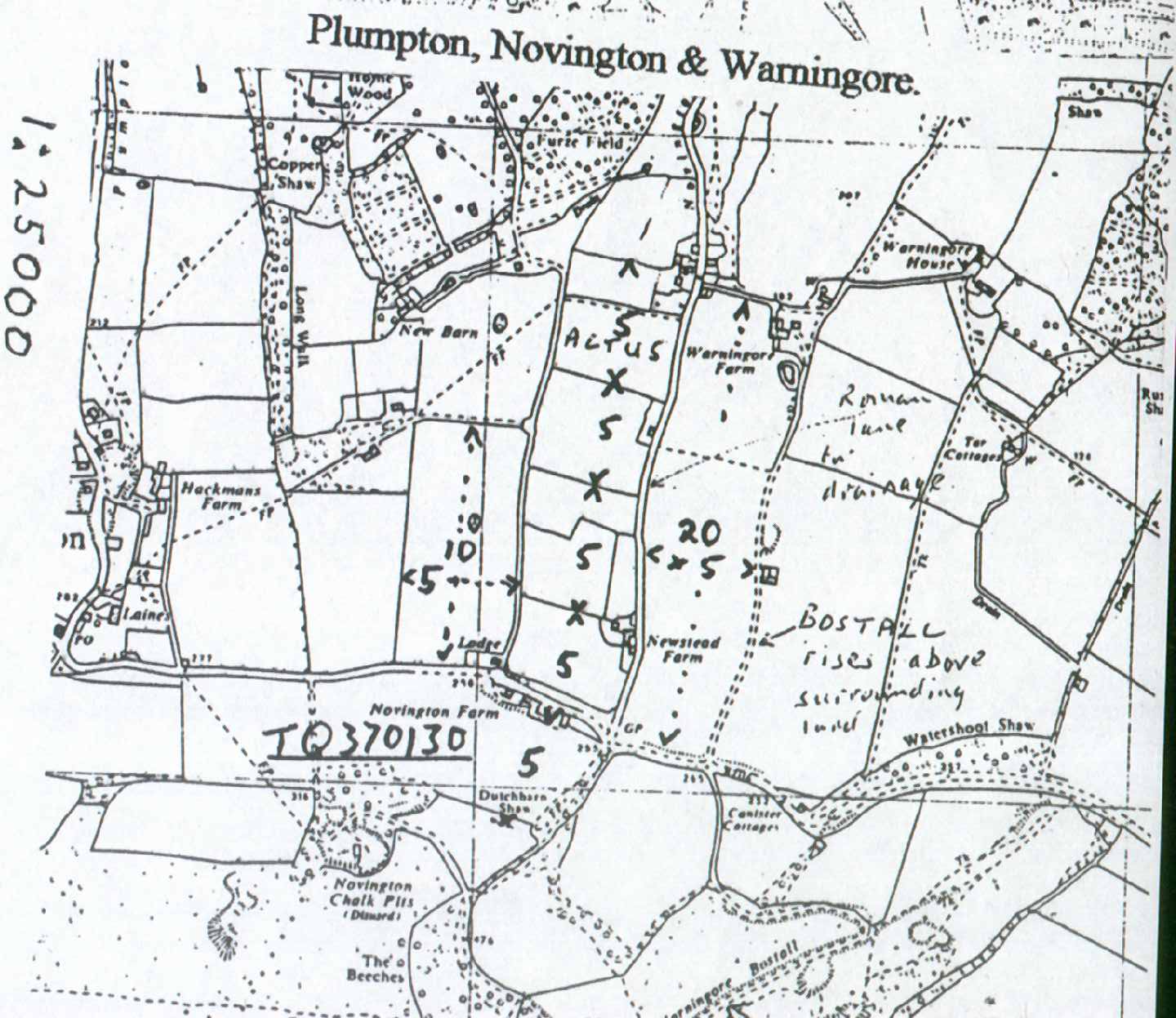
After studying the Roman size fields for Ripe in February 72 with the Historical Society the quest for similar local fields led me to Novington Lane, TQ132371. None of the fields are perfectly square but that could be because the boundaries were compromises to satisfy local chiefs or owners. Use old O.S. maps. From the bank behind Novington Farm there are 4 boundaries, very approximately 5 actus intervals to the North. South of the bank is a terrace, Dutch barn Shaw. It is less than 5 actus from the farm bank but where Ordnance Survey workers would measure from the edge Romans would have included the flat, cultivated part and to the back of the terrace is 5 actus from the farm bank. A field to the east is 10 x 5 actus, to the west about 20 x 5 actus totalling n early half of a tax-free centuria. Perhaps more interesting are the roads and lanes. The earthen lane from Warningore Farm south to the steep scarp slope is a constant gradient as though built for a railway, 4 or 5 feet above the fields in the early parts, but with cuttings deeper than 4 ft as it approaches the steeper slope. There the lane becomes steeper and retains that gradient, till it joins the very deep Warningore Bostel which is also at that constant gradient. At that junction there is a small ring of soil on the left hand side, which could be the meeting place, somewhere to pitch a tent. On one old map a bostel is labelled “Bos Hill Road”. Bos is Latin for oxen. Perhaps the Roman ex-soldier not only provided protection for travellers to Shoreham Harbour, the nearest port, but also provided extra oxen for the steeper Bos Hill Roads. I did check the oldest O.S. maps to make sure that the Bostel had been constructed before world war activities intervened.