WOOLSTONBURY (MAPS 6 &
7)
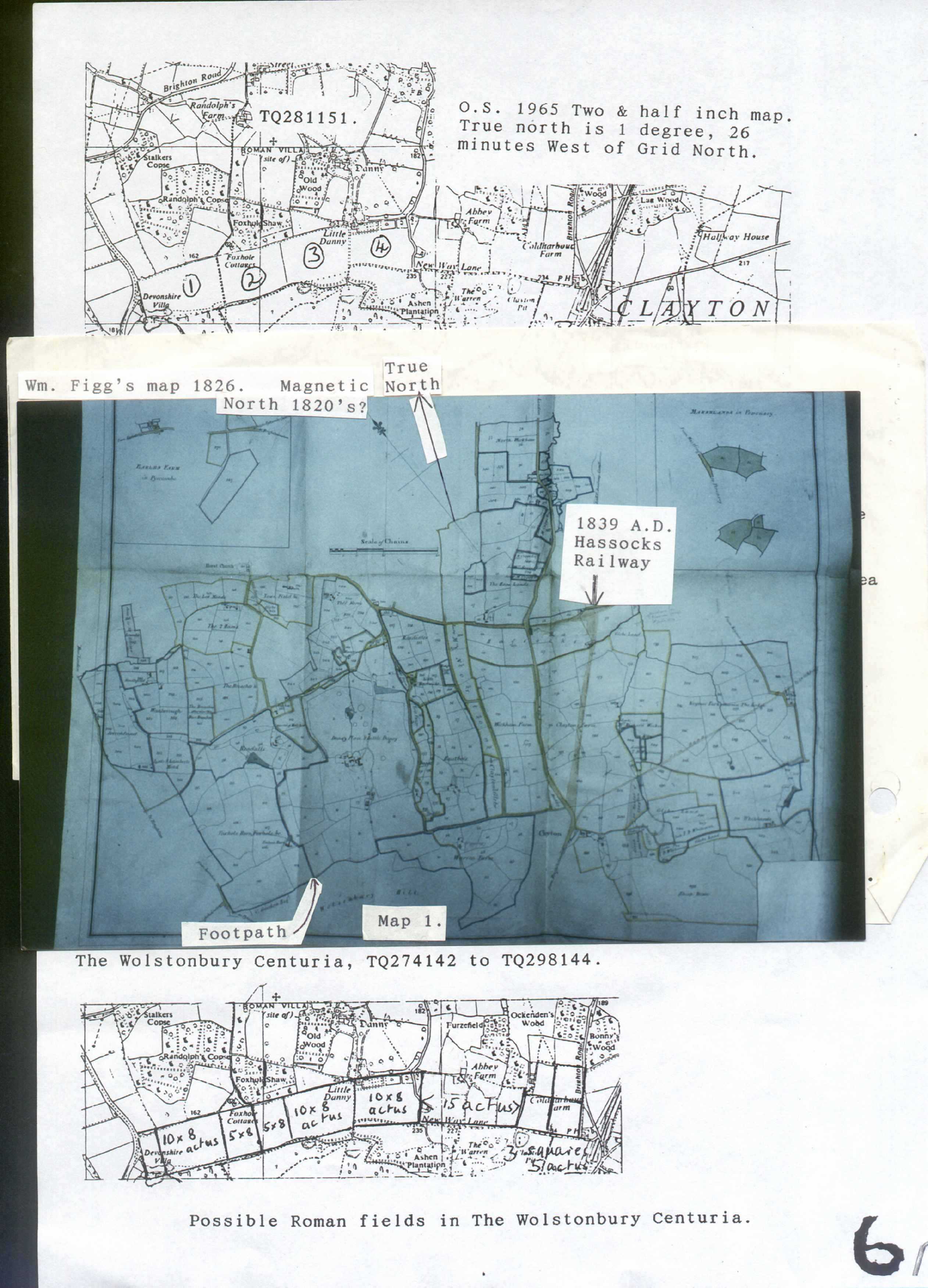
Below the steep,
northern side of Wolstonbury are fields that are 10 by 8 actus, 1/5th
of a taxable centuria. A friend pointed out that I could add a field
of 10 by 8, (No 1) if I used the old Parish Boundary which was no
longer on the O.S. map. It has been moved to the western field. Later
I saw a hedge on the “old” boundary! The next field, (No.
2, travelling east), is shown on the complete Danny Estates map as
two 5 x 8 actus fields, with the footpath between them. But on O.S.
maps the footpath has been moved westward to create a 10 x 8 field.
The
3rd field is bounded to the south by the Pyecombe Parish
Boundary and to the east by a very high-banked earthen road. If this
road was built up when land below Wolstonbury was frequently flooded
and badly drained the road could be very much older than Roman times.
Roman surveyors would ignore the fact that it did not form a true
rectangle. Was the footpath from the hollow above needed to carry
chalk for roads and buildings or was the hollow the place where
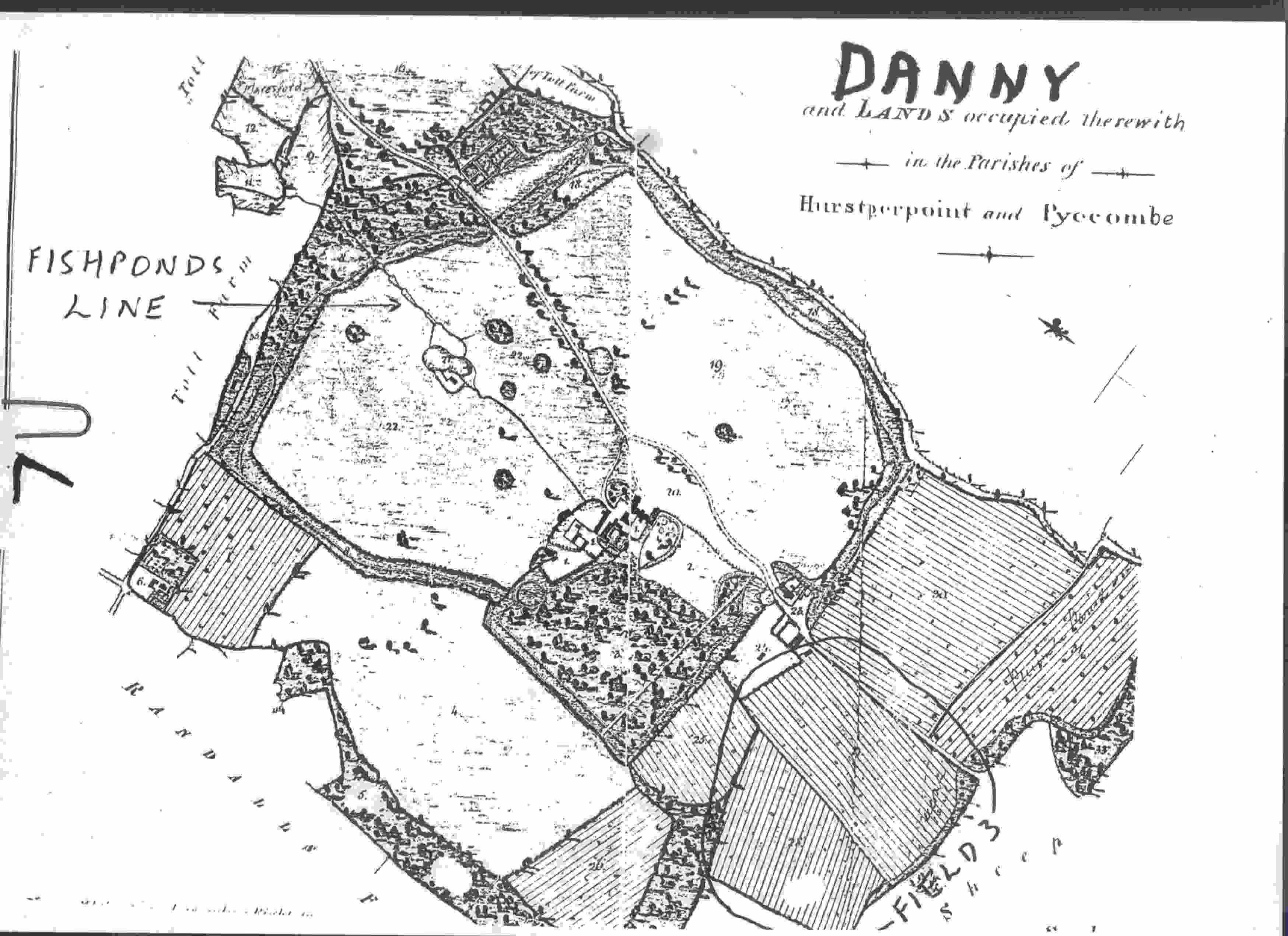
people lived, a dwelling? Another line shown on Figg’s map of
Danny travels from another chalk hollow through where Danny House
would later be built and on to an unusual “straight stream”,
probably made for fishing, a very important food in times past. It
crosses through No 3, a 10 x 8 actus field. Perhaps the hollow was a
pre-Roman home. Perhaps closer inspection could give more evidence
just as the accurate survey of Washbrook Farm did.
The
4th field is doubtful but the southward slippage over many
years could account for the southern edge and the odd little
triangular field to the northwest might have belonged to the
rectangle. Further east are boundaries that can be measured in actus
terms.
A
Roman villa has been found, ref. TQ281151, and since Romans were very
good at drainage it is likely that they drained the fields below
Wolstonbury. This would reduce the damage caused when heavy downpours
flooded below the scarp slopes. It would seem that the parish
boundaries were already there, see fields 1, 3 & 4, just as they
were for the 8 parishes from Clayton eastwards with their ley lines.
---o---
To go to the next page click HERE
To go to the previous page click HERE
To return to the contents page click
HERE